This Old Neighborhood...
Pictured below is an aerial view of the neighborhood we lived in 25 years ago on Racoon Key, near Key West.
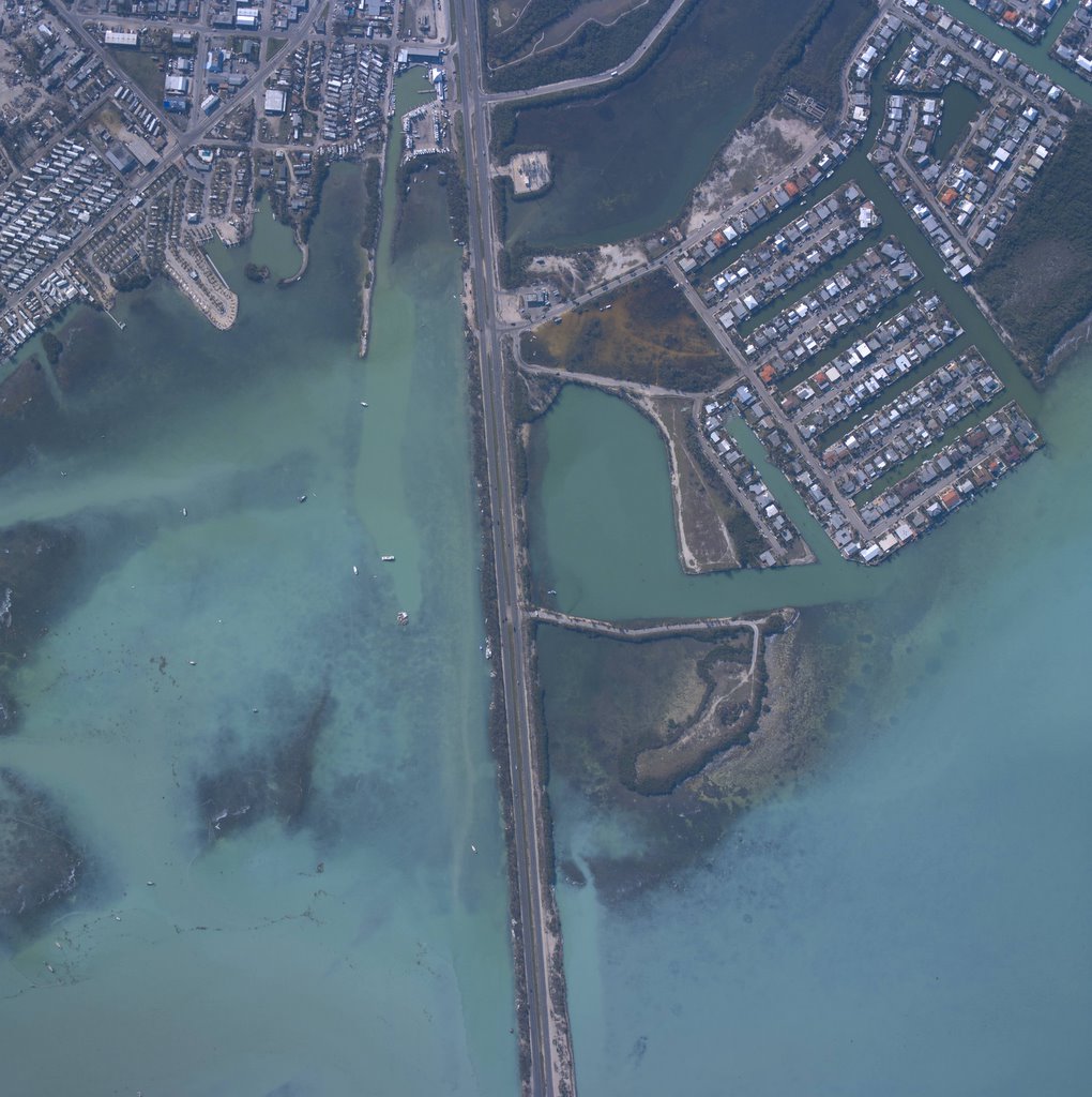 This high resolution photo was taken by NOAA (National Oceanic and Atmospheric Administration) in the past few days as a service to help identify damage from Hurricane Wilma. Usually our old neighborhood which is the one immediately on the right of the "highway" is not visible in detail on products like "Google Earth" because it sits roughly 2 1/2 miles from the runways of Boca Chica Naval Air Station. The picture can be enlarged here twice by clicking on it.
I don't know for certain if the area called "Key Haven" had serious flooding or not.
I do know from reading local papers that the area across the highway which is mostly mobile homes had about three feet of flooding. My downloaded version of this picture can be magnified to the point where one can see boats at a marina in that area piled up on each other.

Approximately 70 % of Key West was flooded when Wilma passed by and newspapers report that thousands of automobiles on the Island were ruined beyond repair by those flood waters.
Key West City Manager Julio Avael is estimating $ 100 million damage to the city from the storm.
Power and water have been restored to all but about 500 customers in the Florida Keys.
posted by jipzeecab @ 12:00 AM
1 Comments
![]()


1 Comments:
Rest assured the hotels and bars have already reopened in Key West. Even the Casa Marina Resort which sustained flood damage to its "common facilities" is providing rooms for a long planned "Parrothead Convention" which is being held this coming weekend.
There are, however, already complaints that FEMA has taken many of the better hotel rooms in the downtown area..
Post a Comment
Subscribe to Post Comments [Atom]
<< Home